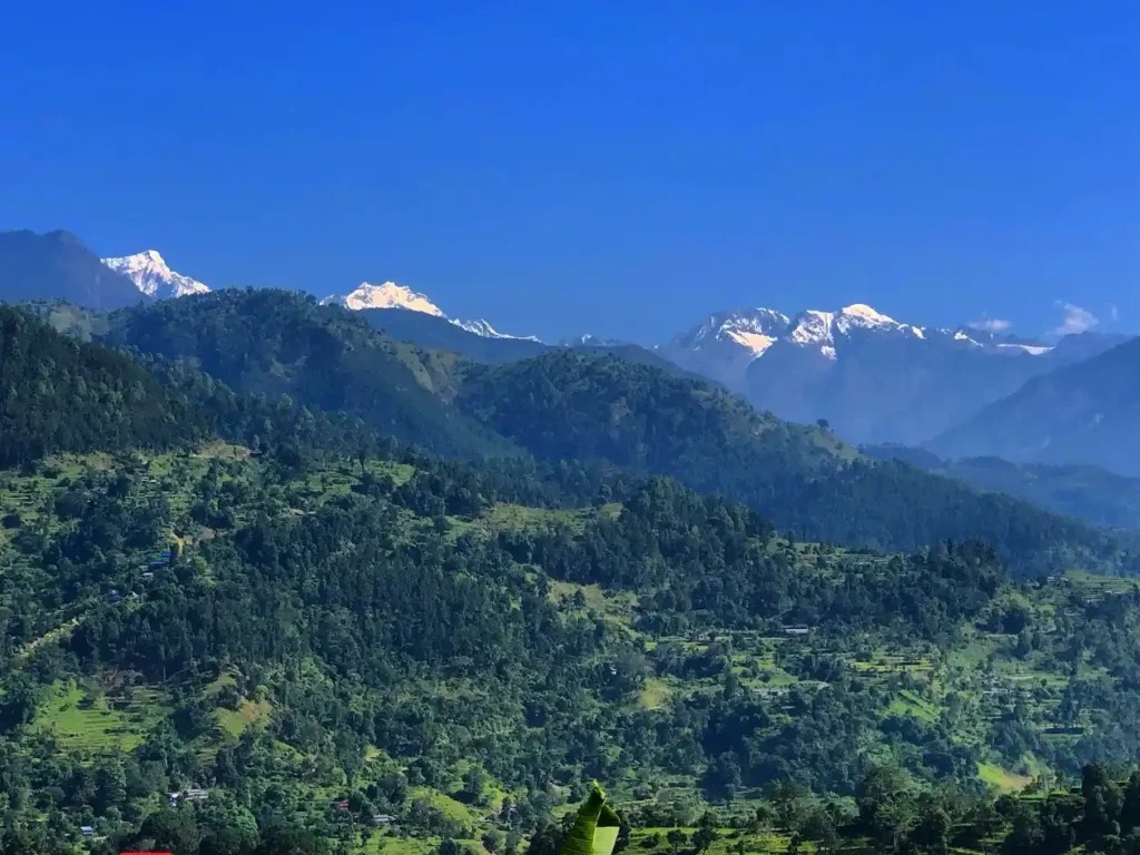
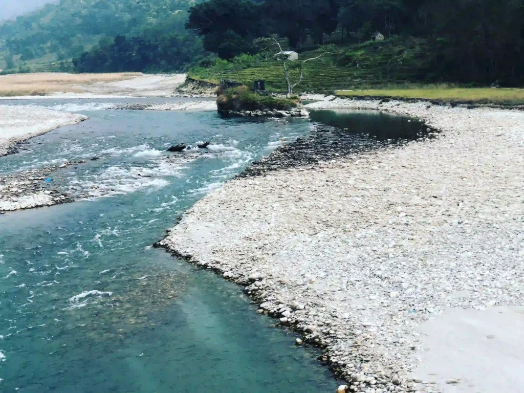
Nepal is home to more than 6000 rivers flowing from East to west, each of which significantly affects the country’s ecosystem and economy. Among them, the Netrawati River is underrated in the Dhading district. Flowing through the source of the Ganesh Himal range, Kalo Kunda, and Seto Kunda, the River is a significant source of support for the surrounding residents. On the trek trail to the Manaslu circuit, trekkers must cross the River by the bridge at Taribenshi.
Lying in Dhading district, Bagmati zone, and province number 3, the district has more than 1743 rivers and smaller rivers, springs, and seasonal streams. Netrawati is one, with its crystal clear water and beautiful surroundings.
The Charanga Dhading is over 200 km long and flows East to west. The River’s width at the top is 5-7m, and at the bottom, it is 30-35m wider. Many streams join into the Ankhu Khola; at the end, the River joins at Budhi Gandaki.

As the source of Netrawati is in the Himalayan high-altitude ranges, it flows down, creating cascading waterfalls and gorges that add to the region’s natural beauty. The River flows across different ecosystems and provides vital nutrients for various plants and fauna. The surrounding lands where the rivers flow are the areas with high biodiversity, helping conserve unique species and promoting ecological balance.
The water flow density varies throughout the year. During the monsoon (June to August), the River overflows with extreme water; it becomes narrower and smaller during the dry season.
Due to heavy rainfall from monsoons and snowmelt from the Himalayas, flood problems are high. The heavy flow of water on the River causes vast landslides in the villages and terraced fields.
Despite its causes during the monsoon, the River plays an essential role in the economic well-being of people near its banks. It supports the area’s agriculture on fertile land by providing proper irrigation facilities for crops like rice, wheat, and maize. Furthermore, the River’s hydroelectric potential helps Nepal’s energy-producing capacity.

Netrawati River or Ankhu Khola Hydropower
Located in Dhading district and 132 km from the capital city of Nepal, the Ankhu Khola hydropower project represents a remarkable achievement in the country’s sustainable energy development. The powerhouse lies on the right bank of the River at Sisneri Khet in Rigna Bazar of Dhading.
Ankhu Khola is another name for the Netrawati River. Hence, the primary source of the Ankhu Khola Hydropower Project is the Ankhu Khola. The hydropower utilizes the flow.
The project site of Ankhu Khola hydropower is at 28000 ’00” to 28000′ 57″ N latitude and 84054 ’00” to 84055′ 32″E longitude. A while back, the capacity produced by hydropower was 7.0 MW, then it increased to 804 MW. The capacity currently in use is 8.4 MW. The intended output for 8.4 MW is 34.50 m3/s. Hence, the total contribution of the Ankhu hydropower project to the nation is 8.4 MW.
Local area Nearby the River
The River flows through different areas and settlements in the Dhading district. It winds through beautiful settlements of various ethnic groups, including Brahmin, Chettri, Newar, Sherpa, and Tmanag. Each ethnic group has different dialects and religions. The Brahmin and Chettri of the area speak the proper Nepali language, and other groups speak their language.
The well-known local areas are:
Gtalang
Gtalang is a small hamlet in the Dhading district, Bagmati zone, province number 3. Most people living in Gtalang are Tamang communities that follow the Buddhist religion. Most of the locals engage in farming. The villagers from Gatlang are not well educated and still follow old traditions.
Tipping
Tiplang is the Rubivalley village, a rural municipality in the Dhading district. It lies near the River of Netrawati. The town became famous after its motorway connection with Dhading Besi. The primary religion of the Tipling village is Christianity. According to the 1991 census, the area had a population of 2092 and 436 houses.
Lapa
Lapa is a small settlement near the River Netrawati. The village lies within Ruby Valley in the Dhading district, in the central part of Nepal, in the Bagmati Zone. According to the census results published in 1991, the village had a population of 3809 and 757 houses. The primary religion of the town is Buddhism.
Rigaun
Rigaun/ Ree gaun is a village development committee of Dhading in central Nepal in the Bagmati zone. The village lies within the Northern part of Dhading. The town comprises wards 1 and 2 of Ganga Jamuna Rural Municipality. The major religions of the area are Christian, Bon, and Buddhist, with 90% of the Tamang ethnic group and some with Gurung, Kami (BK), and Damai. The area’s locals make their livelihoods in agriculture by providing irrigation from Netrawati’s River.
Tripureshwor/Khahare
In Dhading district, Tripureshwor/ Khara is a village development committee of the Bagmati Zone in the central part of Nepal. The 1991 census of Nepal showed that the village had a population of 2707 and 497 houses.
Among one of the mid-north village development committees that was politically stable and famous during the conflict of 10 years in Nepal, the Tripureshwor village is one. The village is now well doing and has facilities like hotels and schools. Furthermore, the major religion of the Tripureshwor village is Hinduism.
Lapang
Lapang lies in Tripurasundari municipality of Dhading district. It lies near the Ankhu Hydropower project. The village is on plain land. Most of the locals of Lapang are farmers and follow the Hindu religion. The town’s winter temperature is humid.
Taribeshi:
Taribeshi is a small village in the Dhading district of Bagmati province and the Nilkantha municipality. The village is 82 km north of Kathmandu and lies 700m above sea level. Tarisbeshi is also near Budhi Gandaki Hydropower. The village offers small hotels and lunch places.
The trail leads two ways from Taribeshi: the Salyantar, Arughat, and Manaslu circuits and Khahare, Lapang, and Ganesh Himal.
Salyantar
Salyantar is a beautiful place that can be reached through Tribeshi. The village lies within the central development region, Dhading district. The town is becoming more populated due to the establishment of modern facilities like health posts, education, and infrastructure.
Salyantar is a settlement with locals of different ethnic groups, including Kumai, Newar, Darai, and Chettri. The village is well known for its most extensive tar and where Sri Narsimha Dham Kshetra lies. The principal occupation of the village’s locals is agriculture, with millet and pulses being a significant production source. Furthermore, the four well-known rivers encircle the village: Netrawati in the south, Budhigandaki in the west, Hyapinge in the East, and Kaste in the north. Thus, the town is a perfect mixture of beauty, diverse culture, and agricultural practices.
Arughat
In the Gandaki province of Gorkha district, Arughat is a well-known settlement at an elevation of 570m. The flowing Budhi Gandaki River adjoining the Arughat adds to the village’s charm. Also, hills, mountains, and terraced fields encircled the town, making it visually attractive.
One primary reason Arughat is well known is that the village is the starting point of the famous trekking route, Manaslu Circuit. Trekkers must pass through the town to start their thrilling journey on Manalsu.
Although Arughat is accessible by road and one can reach the village within 5-6 hours of drive from Kathmandu, the town provides insight into traditional Nepali villages. The villagers built the houses with stone, mud, wooden windows, and doors. The villagers of Arughat are engaged in agricultural practice and animal husbandry to sustain their livelihood.
Religion
The residents follow the Nepalese caste system, which consists of four broad classes, varna. As the locals believe in the caste system, they follow their castes. Each caste has its religious traditions and customs. Thus, the villages near the River of Netrawati consist of numerous religions.
At the higher points, including Gtalang, Tipling, Lapa, and Rigaun, locals are mainly from Tamang communities and follow Buddhism. Below Riguan, the majority of the locals follow the Hindu religion. In Tripureshwor, Khahare, Lapang, and Taribeshi villages, you’ll see ethnic communities of Brahmin and Chettri that mostly follow Hinduism.
Furthermore, temples to worship by the Hindus are also there, as you get below Tripureshwor. Tripura Sundari’s temple is one of the significant temples for Hindus in the area where Ankhu Khola flows alongside. The temple holds great significance for Hindus in the region.
Budhi Gandaki River
The Ankhu Khola is connected to the Budhi Gandaki River, as the Netrawati joins the Budhi Gandaki at Benighat. Although the Budhi Gandaki Khola is more significant than the Netrawati, both rivers hold significance.
Although the major source of the Budhi Gandaki River is the Manaslu mountain range, the River’s headwaters are Budhi Gandaki, Kali Gandaki, Seti, Trishuli, Rapti, Madi, and Marsyangdi. The River’s basin lies in the central part of Nepal, with longitudes from 84˚30′ to 85˚10’E and Latitudes from 27˚50′ to 29˚00’N. The River is more than 320m long along with the Basin, encompassing an area of around 6,950 square kilometers, and flows from East to West.
The River has significantly impacted Nepal’s economy in several ways. Among all the Budhi Gandaki Hydropower projects is one. The project uses the River’s potential to generate electricity. The project aims to contribute to Nepal’s electrical sector by supplying a large amount of environment-friendly and renewable electricity.
The Budhi Gandaki Hydropower is the biggest hydropower project in Nepal, With an estimated available capacity of 1,200 MW. The project is in two parts of Nepal: Ghyalchok, Gorkha District, Western Development Region, and Dhading District, Central Development Region. The project’s total capacity is 3,3 km3 with a Catchment area of 5.000 km² and a Surface area of 49.8 km². The hydropower project has a Maximum length of 45 km, whereas its minimum elevation is 540 m. However, the Budhi Gandaki Hydropower project is under construction.
Conclusion
All in all, even though the Netrawati is an unnoticed river in the Dhading district, the River holds immense significance. It has potential for the well-being of the People and economy of Nepal. With its role in supporting agriculture through irrigation and providing sustainability to biodiversity, the River is the basis of survival for locals in the ecosystem.
Its role in Ankhu Khola hydropower is also noteworthy. Its crucial role in providing energy and creating potential for hydropower development contributes to Nepal’s economy and development.
Nepal can maximize the potential of the Ankhu Khola rivers for sustainable development and progress while preserving its identity and maintaining a balance between development and conservation. However, the Netrawati River, Also Known as Ankhu Khola, is famous locally.

